Before & After: Oso Washington Landslide
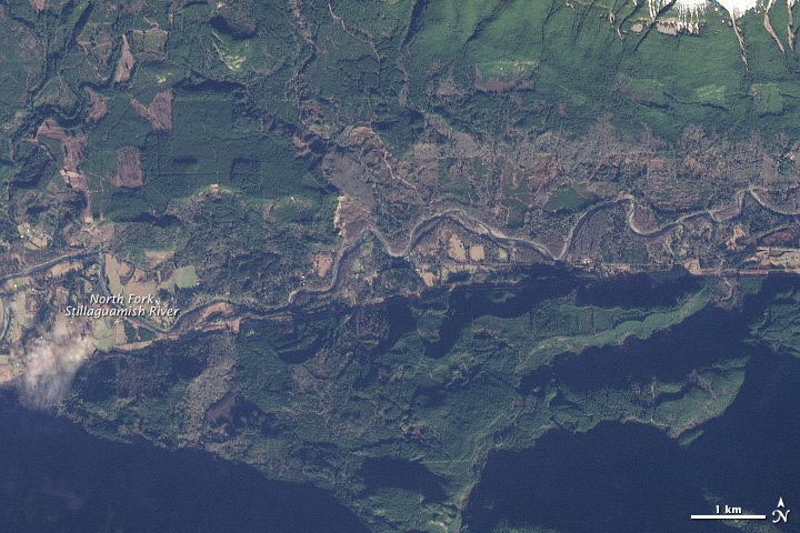
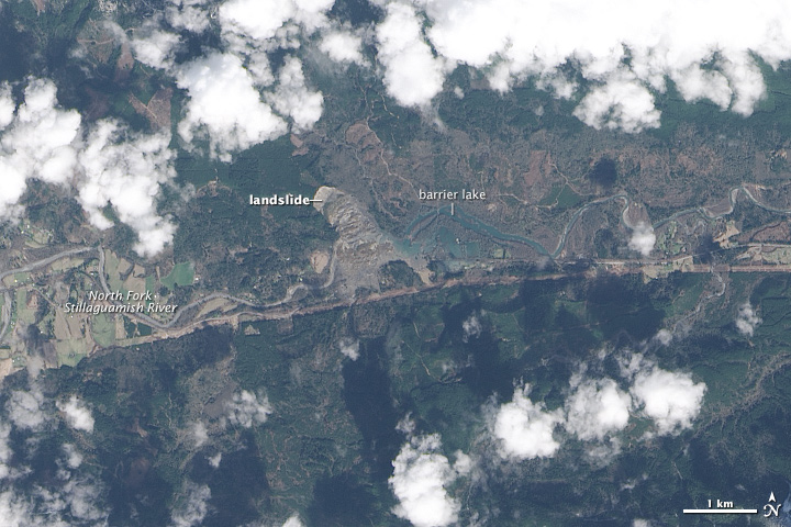
The landslide created a dam that blocked the river, causing a barrier lake to form. The Operational Land Imager (OLI) on Landsat 8 obtained this image of landslide debris and the barrier lake on March 23, 2014. An image of the same area taken on January 18 reveals the damage the landslide caused.
According to a Durham University geologist, the landslide was a reactivation of an earlier landslide that caused problems in 1988 and 2006. A report filed with the U.S. Corp of Engineers in 1999 warned that the hillside had the “potential for a large catastrophic failure.”
Popular Today
- Ex-Shield AI Worker Sues Over ‘Profane, Egregious’ Acts by Senior Official
- Car Owners Shocked by $200 Gas Bills Finally Embrace Used EVs
- The Field Inspection Gap: A Growing Structural Risk in Claims Handling
- The Future of Appraisal and the Rising Standard of Competency
Popular This Month